The eastern end of Great Torrington
Introduction
The photograph on this page of The eastern end of Great Torrington by Roger A Smith as part of the Geograph project.
The Geograph project started in 2005 with the aim of publishing, organising and preserving representative images for every square kilometre of Great Britain, Ireland and the Isle of Man.

There are currently over 7.5m images from over 14,400 individuals and you can help contribute to the project by visiting https://www.geograph.org.uk
The eastern end of Great Torrington
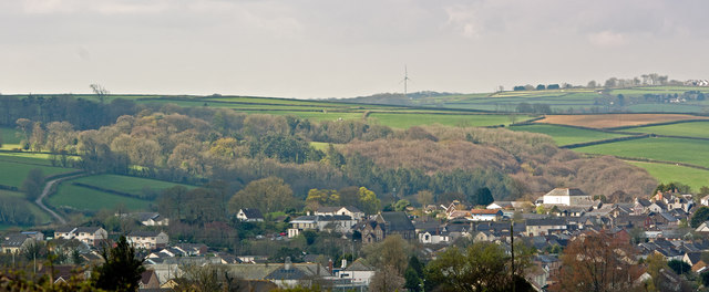
Image: © Roger A Smith Taken: 6 Apr 2017
Howe Concert Hall, formerly the Congregational Church, is on Castle Street is just below centre. The Pannier Market is to the right and a lane leading off from Mutton Lane is to the left.
Images are licensed for reuse under creativecommons.org/licenses/by-sa/2.0
Image Location
Latitude
50.951275
Longitude
-4.141268