Canniesburn Care Home
Introduction
The photograph on this page of Canniesburn Care Home by Richard Sutcliffe as part of the Geograph project.
The Geograph project started in 2005 with the aim of publishing, organising and preserving representative images for every square kilometre of Great Britain, Ireland and the Isle of Man.

There are currently over 7.5m images from over 14,400 individuals and you can help contribute to the project by visiting https://www.geograph.org.uk
Canniesburn Care Home
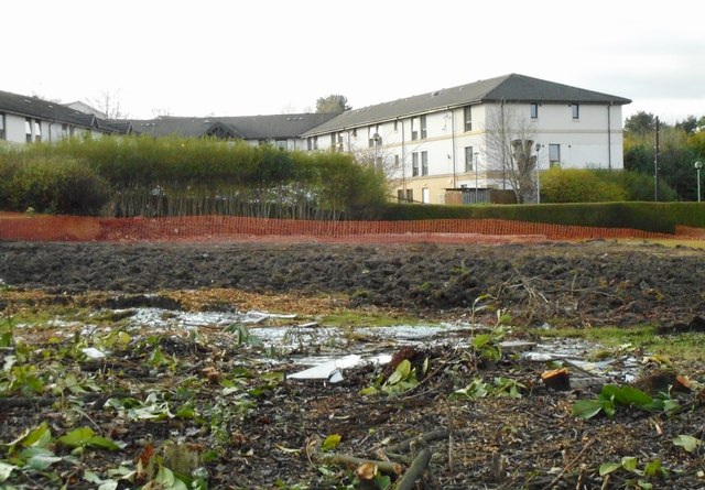
Image: © Richard Sutcliffe Taken: 5 Apr 2017
Seen from Switchback Road. This view did not exist until a private house and garage were demolished in March 2017, and the site cleared. A three storey building with 23 two-bedroom retirement flats is due to be constructed here.
Images are licensed for reuse under creativecommons.org/licenses/by-sa/2.0
Image Location
Latitude
55.909637
Longitude
-4.32653