Robb's Ferry House, Derrycarne Road, Portadown.
Introduction
The photograph on this page of Robb's Ferry House, Derrycarne Road, Portadown. by P Flannagan as part of the Geograph project.
The Geograph project started in 2005 with the aim of publishing, organising and preserving representative images for every square kilometre of Great Britain, Ireland and the Isle of Man.

There are currently over 7.5m images from over 14,400 individuals and you can help contribute to the project by visiting https://www.geograph.org.uk
Robb's Ferry House, Derrycarne Road, Portadown.
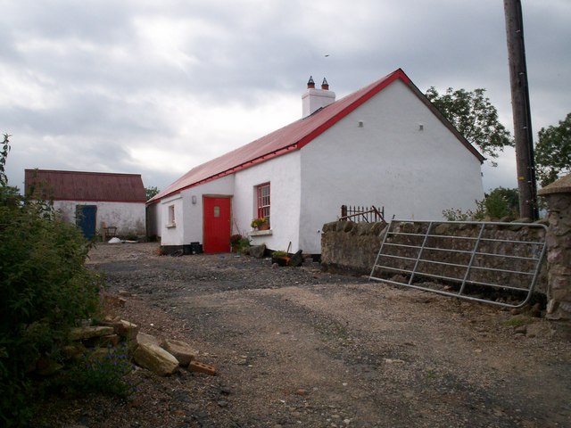
Image: © P Flannagan Taken: 23 Aug 2007
This is a single storey, four bay house overlooking a treelined lane running east to the River Bann. It is of special interest, not only by association with the Ferry, but also because of its compacted mud wall construction.
Images are licensed for reuse under creativecommons.org/licenses/by-sa/2.0
Image Location
Latitude
54.455866
Longitude
-6.435764