
Upstream in Rochdale
Introduction
The photograph on this page of Upstream in Rochdale by Gerald England as part of the Geograph project.
The Geograph project started in 2005 with the aim of publishing, organising and preserving representative images for every square kilometre of Great Britain, Ireland and the Isle of Man.

There are currently over 7.5m images from over 14,400 individuals and you can help contribute to the project by visiting https://www.geograph.org.uk
Upstream in Rochdale
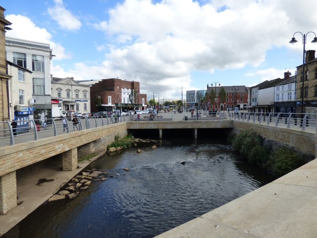
Image: © Gerald England Taken: 22 Sep 2016
Looking from the bridge over the River Roch Image This section of the river was covered over and tramlines laid in 1900. After the trams came the buses Image outside Montague Burtons Image, Williams Deacon's bank Image and the Regal Cinema Image on the left. The buses later moved to a new bus station now demolished in favour of a newer bus station. The Town Centre stretch of the river was briefly exposed, together with part of the old bridge, when remedial work had to be done in 1996 Image, but it was covered over again then the work was completed. Now new trams have come to town in the shape of Metrolink whose terminus is on the site of the first bus station. Plans to uncover two sections of the river and expose the historic bridge were drawn up in 2014. The work was finally completed in 2016.
Images are licensed for reuse under creativecommons.org/licenses/by-sa/2.0
Image Location

Latitude
53.616771
Longitude
-2.15778