Coleford Aqueduct
Introduction
The photograph on this page of Coleford Aqueduct by Robin Webster as part of the Geograph project.
The Geograph project started in 2005 with the aim of publishing, organising and preserving representative images for every square kilometre of Great Britain, Ireland and the Isle of Man.

There are currently over 7.5m images from over 14,400 individuals and you can help contribute to the project by visiting https://www.geograph.org.uk
Coleford Aqueduct
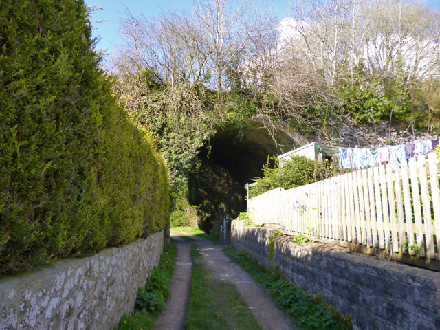
Image: © Robin Webster Taken: 2 Apr 2017
A two-arched structure on the Dorset and Somerset Canal. The canal was never completed (only this Nettlebridge branch was tackled) and never used. There is even some doubt if all sections of the branch were dug, certainly the flight of boat lifts at the major change of level were never finished. A good view of this aqueduct is prevented by adjacent properties - the second arch is behind the hedge on the left. A view from the other side is even worse, unless permission to enter someone's garden is granted, when both arches are visible - see Image If not, the public footpath under the arch offers no views as thickly hedged in against the east side of the valley from a point immediately past the arch. A grade II listed building.
Images are licensed for reuse under creativecommons.org/licenses/by-sa/2.0
Image Location
Latitude
51.236964
Longitude
-2.452728