Grange Farm farmhouse
Introduction
The photograph on this page of Grange Farm farmhouse by Richard Law as part of the Geograph project.
The Geograph project started in 2005 with the aim of publishing, organising and preserving representative images for every square kilometre of Great Britain, Ireland and the Isle of Man.

There are currently over 7.5m images from over 14,400 individuals and you can help contribute to the project by visiting https://www.geograph.org.uk
Grange Farm farmhouse
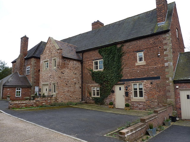
Image: © Richard Law Taken: 19 Mar 2017
A rather fine early 17th century (mainly stone) farmhouse, with later brickwork additions and extensions. The building was given Grade II listed status in 1983, and frankly has done rather well to survive the rampant development work that took place through Telford new town in the 1960s and 70s. Following some years in a rather poor state of repair, such as seen in Image, it's now been rather well refurbished into modern houses. Details of the listing are at https://britishlistedbuildings.co.uk/101292585-grange-farm-farmhouse-stirchley-and-brookside#.YZKe4GDP3IU & https://historicengland.org.uk/listing/the-list/list-entry/1292585
Images are licensed for reuse under creativecommons.org/licenses/by-sa/2.0
Image Location
Latitude
52.659899
Longitude
-2.441127