Path to Warfleet
Introduction
The photograph on this page of Path to Warfleet by Derek Harper as part of the Geograph project.
The Geograph project started in 2005 with the aim of publishing, organising and preserving representative images for every square kilometre of Great Britain, Ireland and the Isle of Man.

There are currently over 7.5m images from over 14,400 individuals and you can help contribute to the project by visiting https://www.geograph.org.uk
Path to Warfleet
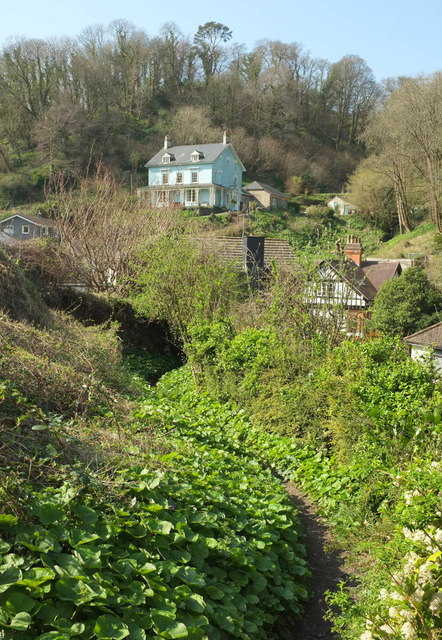
Image: © Derek Harper Taken: 26 Mar 2017
A permissive path dropping from woodland below Gallants Bower to meet Weeke Hill. The prominent hillside house with verandah is Woodlands. "According to the owners, Woodlands was built for the manager of Warfleet Brewery, now the Dartmouth Pottery" https://www.historicengland.org.uk/listing/the-list/list-entry/1218363 - and now flats - see Image
Images are licensed for reuse under creativecommons.org/licenses/by-sa/2.0
Image Location
Latitude
50.341416
Longitude
-3.574174