
Afon Cadnant
Introduction
The photograph on this page of Afon Cadnant by Jonathan Wilkins as part of the Geograph project.
The Geograph project started in 2005 with the aim of publishing, organising and preserving representative images for every square kilometre of Great Britain, Ireland and the Isle of Man.

There are currently over 7.5m images from over 14,400 individuals and you can help contribute to the project by visiting https://www.geograph.org.uk
Afon Cadnant
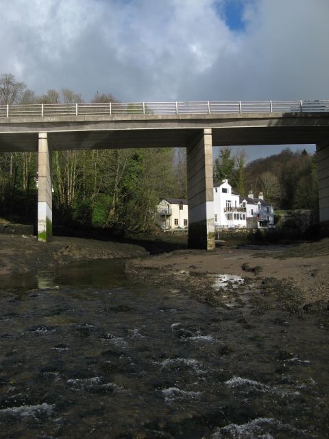
Image: © Jonathan Wilkins Taken: 2 Apr 2017
The deep valley of the Afon Cadnant was crossed by a new bridge in 1973, making a quiet enclave of the old road with its buildings rising from the tide-line. The valley is the result of erosion along a dual feature, a minor fault cutting the Precambrian schist and a Palaeogene microgabbro dyke which has weathered into oblivion, as have several associated, major dykes along the shore of the Menai Strait. These were described by Professor John Henslow of Cambridge University in his seminal work on the geology of Anglesey published in 1822.
Images are licensed for reuse under creativecommons.org/licenses/by-sa/2.0
Image Location

Latitude
53.232848
Longitude
-4.158133