Former Dartmouth Pottery
Introduction
The photograph on this page of Former Dartmouth Pottery by Derek Harper as part of the Geograph project.
The Geograph project started in 2005 with the aim of publishing, organising and preserving representative images for every square kilometre of Great Britain, Ireland and the Isle of Man.

There are currently over 7.5m images from over 14,400 individuals and you can help contribute to the project by visiting https://www.geograph.org.uk
Former Dartmouth Pottery
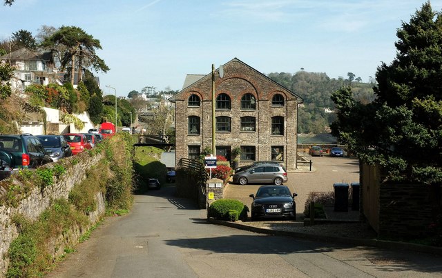
Image: © Derek Harper Taken: 26 Mar 2017
All the images so far of this building at Warfleet seem to show the other end. Built as a brewery, later a pottery, and now divided into 9 flats and called "The Pottery". "Dated 1819 ... Both end walls in the same style; 1:2:1-window ranges divided by giant pilasters to round arches and top windows with round-headed arches. Because of the slope, the ground-floor level is buried at the uphill end" https://www.historicengland.org.uk/listing/the-list/list-entry/1197637 .
Images are licensed for reuse under creativecommons.org/licenses/by-sa/2.0
Image Location
Latitude
50.341863
Longitude
-3.574329