Trevego
Introduction
The photograph on this page of Trevego by Derek Harper as part of the Geograph project.
The Geograph project started in 2005 with the aim of publishing, organising and preserving representative images for every square kilometre of Great Britain, Ireland and the Isle of Man.

There are currently over 7.5m images from over 14,400 individuals and you can help contribute to the project by visiting https://www.geograph.org.uk
Trevego
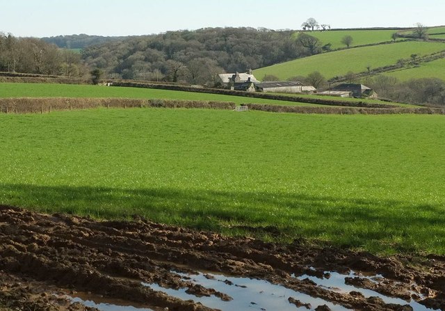
Image: © Derek Harper Taken: 25 Mar 2017
A detail of the scenes in Image] and Image The grade II* listed farmhouse was built as a dower house for the "widow of Sir William Mohun who purchased Boconnoc in 1579" https://www.historicengland.org.uk/listing/the-list/list-entry/1329287 . It overlooks a tribuary valley of the Lerryn; across the valley is Colwood Wood.
Images are licensed for reuse under creativecommons.org/licenses/by-sa/2.0
Image Location
Latitude
50.408494
Longitude
-4.621843