Coulsdon: Coal Post A
Introduction
The photograph on this page of Coulsdon: Coal Post A by Dr Neil Clifton as part of the Geograph project.
The Geograph project started in 2005 with the aim of publishing, organising and preserving representative images for every square kilometre of Great Britain, Ireland and the Isle of Man.

There are currently over 7.5m images from over 14,400 individuals and you can help contribute to the project by visiting https://www.geograph.org.uk
Coulsdon: Coal Post A
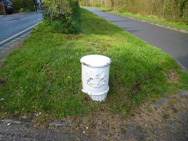
Image: © Dr Neil Clifton Taken: 1 Apr 2017
When walking from Coulsdon via the lane which runs along Farthing Downs, one encounters no less than ten coal posts. For the sake of clarity, I have allocated letters A to J to each of the posts; the letters are as follows: A and B: These posts are not actually on Farthing Downs; they are (one each side) of a very short (c. 3 metres) piece of metalled road connecting Downs Road with the metalled lane that runs north to south along Farthing Downs. This lane,as far as I am aware, has no name, although at its southern end it connects with Ditches Lane. The post in this picture is Post A, the northerly one of two across this short strip of road.
Images are licensed for reuse under creativecommons.org/licenses/by-sa/2.0
Image Location
Latitude
51.313565
Longitude
-0.136401