"Desire path" into Withybush retail park (2)
Introduction
The photograph on this page of "Desire path" into Withybush retail park (2) by Natasha Ceridwen de Chroustchoff as part of the Geograph project.
The Geograph project started in 2005 with the aim of publishing, organising and preserving representative images for every square kilometre of Great Britain, Ireland and the Isle of Man.

There are currently over 7.5m images from over 14,400 individuals and you can help contribute to the project by visiting https://www.geograph.org.uk
"Desire path" into Withybush retail park (2)
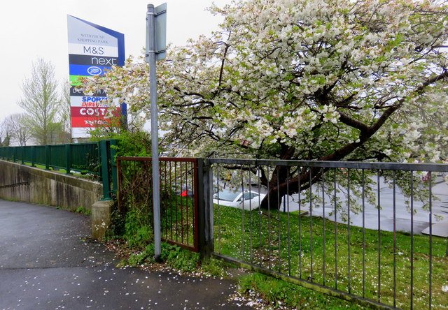
Image: © Natasha Ceridwen de Chroustchoff Taken: 29 Mar 2017
For as long as I have been coming to this small out-of-town shopping centre, when on foot I have made use of this unofficial way in that leads through a gap in the fence and down a bank into the car park. The only alternative for pedestrians is to use the pavement that follows the vehicular access road, clearly judged by many to be an unnecessary detour. These short cuts that ignore planned routes are known as 'desire paths' as they constitute the shortest way to where one wants to go and they may cross landscaped features such a lawns and flowerbeds. Sometimes planners wait until walkers or cyclists have chosen their optimal routes before creating formal versions. Attempts to block the use of desire-paths is usually unsuccessful although in this case mending the fence might stop all but the most determined. See https://en.wikipedia.org/wiki/Desire_path and http://99percentinvisible.org/article/least-resistance-desire-paths-can-lead-better-design/
Images are licensed for reuse under creativecommons.org/licenses/by-sa/2.0
Image Location
Latitude
51.811364
Longitude
-4.963388