
The Farriers Arms (1), Church Road, The Forstal, near Mersham, Kent
Introduction
The photograph on this page of The Farriers Arms (1), Church Road, The Forstal, near Mersham, Kent by P L Chadwick as part of the Geograph project.
The Geograph project started in 2005 with the aim of publishing, organising and preserving representative images for every square kilometre of Great Britain, Ireland and the Isle of Man.

There are currently over 7.5m images from over 14,400 individuals and you can help contribute to the project by visiting https://www.geograph.org.uk
The Farriers Arms (1), Church Road, The Forstal, near Mersham, Kent
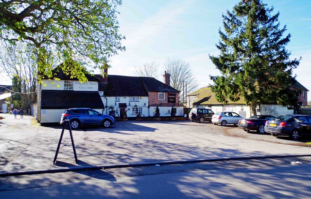
Image: © P L Chadwick Taken: 10 Apr 2016
A Grade II listed public house which is thought to date from about 1606. Some parts were altered and extended in the 18th & 19th centuries. Some years ago both the trade and the building declined and it closed about 2008. Then a large group of villagers and friends got together & raised funds to buy and re-open the pub, which is now a great success. A micro-brewery has now been opened in an out-building. The story is much more involved than this basic summary but it can be read on the pub's website. Image
Images are licensed for reuse under creativecommons.org/licenses/by-sa/2.0
Image Location

Latitude
51.11473
Longitude
0.925955