Damaged bridge at Burnbrae, Alexandria
Introduction
The photograph on this page of Damaged bridge at Burnbrae, Alexandria by Lairich Rig as part of the Geograph project.
The Geograph project started in 2005 with the aim of publishing, organising and preserving representative images for every square kilometre of Great Britain, Ireland and the Isle of Man.

There are currently over 7.5m images from over 14,400 individuals and you can help contribute to the project by visiting https://www.geograph.org.uk
Damaged bridge at Burnbrae, Alexandria
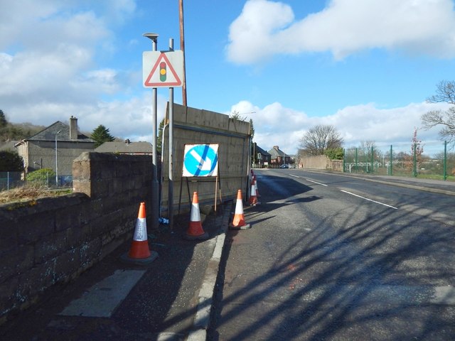
Image: © Lairich Rig Taken: 19 Mar 2017
The bridge takes Main Street, Alexandria, over the railway line. A week before this picture was taken, a vehicle hit the left (west) parapet of the bridge; the resulting gap in the stonework has been covered by boards. The damage was soon repaired: Image For a view of the damaged bridge from the side, see Image
Images are licensed for reuse under creativecommons.org/licenses/by-sa/2.0
Image Location
Latitude
55.980177
Longitude
-4.584211