Properties in Bideford
Introduction
The photograph on this page of Properties in Bideford by Roger A Smith as part of the Geograph project.
The Geograph project started in 2005 with the aim of publishing, organising and preserving representative images for every square kilometre of Great Britain, Ireland and the Isle of Man.

There are currently over 7.5m images from over 14,400 individuals and you can help contribute to the project by visiting https://www.geograph.org.uk
Properties in Bideford
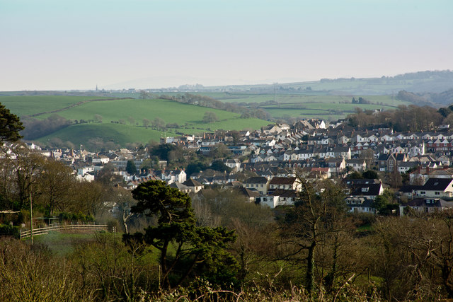
Image: © Roger A Smith Taken: 25 Mar 2017
The centre of this image is the telephone exchange on Pit Lane. Above this and to the right is the Methodist Church on the High Street. Northgate house on North road is to the left.
Images are licensed for reuse under creativecommons.org/licenses/by-sa/2.0
Image Location
Latitude
51.019114
Longitude
-4.209327