Distington (Joint) station, 1951
Introduction
The photograph on this page of Distington (Joint) station, 1951 by Walter Dendy, deceased as part of the Geograph project.
The Geograph project started in 2005 with the aim of publishing, organising and preserving representative images for every square kilometre of Great Britain, Ireland and the Isle of Man.

There are currently over 7.5m images from over 14,400 individuals and you can help contribute to the project by visiting https://www.geograph.org.uk
Distington (Joint) station, 1951
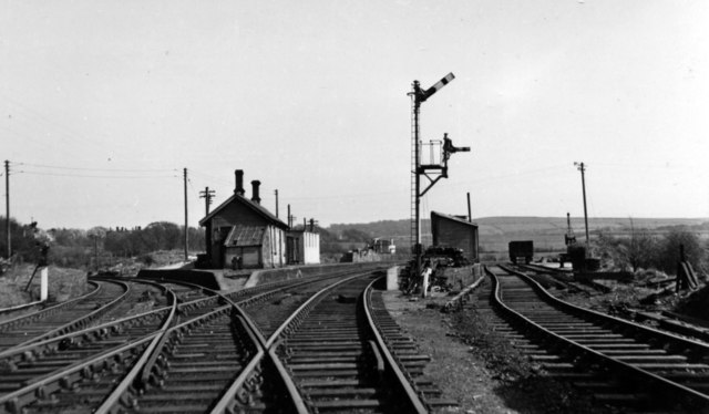
Image: © Walter Dendy, deceased Taken: 14 Apr 1951
View SW, towards Cleator Moor (ahead), left to Rowrah and Kelton Fell also WC&E line to Parton and Ullock. The station was closed finally 13/4/31 (goods C&WJ 1/7/63). Passenger services were withdrawn during the 1920s; goods gradually during the 20s and 30s, and to Cleator Moor until 9/61, then only as a diversionary route. (See also Image).
Images are licensed for reuse under creativecommons.org/licenses/by-sa/2.0
Image Location
Latitude
54.601923
Longitude
-3.531244