Tavistock Canal wharf
Introduction
The photograph on this page of Tavistock Canal wharf by Chris Allen as part of the Geograph project.
The Geograph project started in 2005 with the aim of publishing, organising and preserving representative images for every square kilometre of Great Britain, Ireland and the Isle of Man.

There are currently over 7.5m images from over 14,400 individuals and you can help contribute to the project by visiting https://www.geograph.org.uk
Tavistock Canal wharf
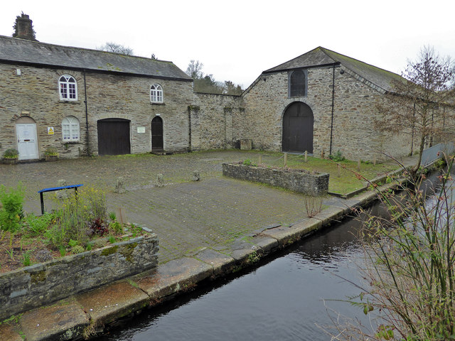
Image: © Chris Allen Taken: 18 Mar 2017
The canal still carries water for a hydroelectric scheme but has been out of use for the carriage of goods for a very long time, having officially closed in 1873. These buildings are at the Tavistock end of the canal. The building on the right with the large door was the coal warehouse and it is thought that a plateway probably entered through the door.
Images are licensed for reuse under creativecommons.org/licenses/by-sa/2.0
Image Location


Leaflet Map data © OpenStreetMap
Latitude
50.547301
Longitude
-4.146905