Norn's Tump long barrow, near Avening
Introduction
The photograph on this page of Norn's Tump long barrow, near Avening by Vieve Forward as part of the Geograph project.
The Geograph project started in 2005 with the aim of publishing, organising and preserving representative images for every square kilometre of Great Britain, Ireland and the Isle of Man.

There are currently over 7.5m images from over 14,400 individuals and you can help contribute to the project by visiting https://www.geograph.org.uk
Norn's Tump long barrow, near Avening
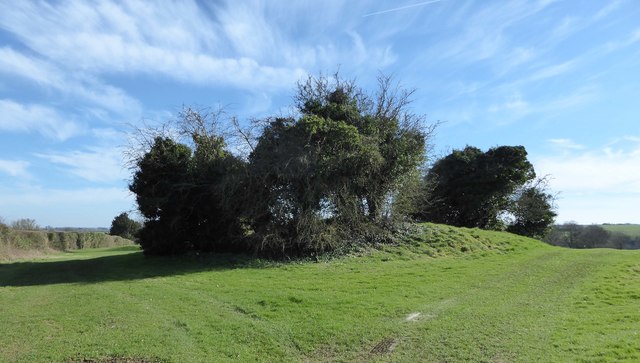
Image: © Vieve Forward Taken: 25 Mar 2017
The long barrow stands close to a public footpath across Minchinhampton golf course. Norn's Tump is orientated SE-NW and has a maximum height of 3.1 m towards the SE end. The NW end (seen here on the left) has been ploughed down to a height of 1.0 m and is now under grass. The higher part has been considerably mutilated and is partly scrub and tree covered. According to Pastscape, an old print of the 'Long Barrow at the Norn' published in 1911 shows two chambers in the side. http://www.pastscape.org.uk/hob.aspx?hob_id=208941
Images are licensed for reuse under creativecommons.org/licenses/by-sa/2.0
Image Location
Latitude
51.684158
Longitude
-2.161666