Hattersley multi-storey flats demolition
Introduction
The photograph on this page of Hattersley multi-storey flats demolition by Stephen Burton as part of the Geograph project.
The Geograph project started in 2005 with the aim of publishing, organising and preserving representative images for every square kilometre of Great Britain, Ireland and the Isle of Man.

There are currently over 7.5m images from over 14,400 individuals and you can help contribute to the project by visiting https://www.geograph.org.uk
Hattersley multi-storey flats demolition
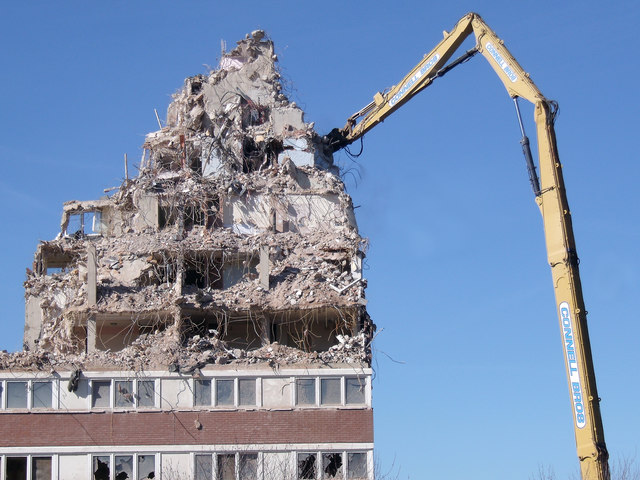
Image: © Stephen Burton Taken: 24 Mar 2017
Powerful machine ripping lumps of reinforced concrete from the last remaining tower block at Hattersley.
Images are licensed for reuse under creativecommons.org/licenses/by-sa/2.0
Image Location
Latitude
53.44897
Longitude
-2.027516