Railway Track
Introduction
The photograph on this page of Railway Track by Alan Hughes as part of the Geograph project.
The Geograph project started in 2005 with the aim of publishing, organising and preserving representative images for every square kilometre of Great Britain, Ireland and the Isle of Man.

There are currently over 7.5m images from over 14,400 individuals and you can help contribute to the project by visiting https://www.geograph.org.uk
Railway Track
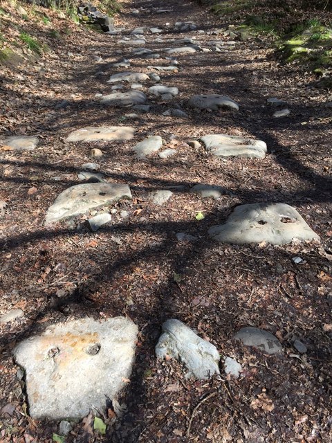
Image: © Alan Hughes Taken: 24 Mar 2017
All that remains of the railway track which ran alongside Nedd Fechan are the stone footings showing the circular holes where the track brackets were secured.
Images are licensed for reuse under creativecommons.org/licenses/by-sa/2.0
Image Location


Leaflet Map data © OpenStreetMap
Latitude
51.75921
Longitude
-3.595763