Church Road
Introduction
The photograph on this page of Church Road by Marathon as part of the Geograph project.
The Geograph project started in 2005 with the aim of publishing, organising and preserving representative images for every square kilometre of Great Britain, Ireland and the Isle of Man.

There are currently over 7.5m images from over 14,400 individuals and you can help contribute to the project by visiting https://www.geograph.org.uk
Church Road
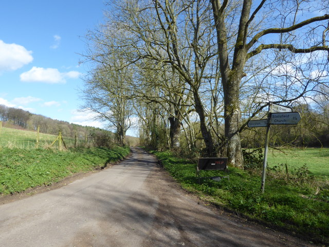
Image: © Marathon Taken: 21 Mar 2017
The church in the road name is Stalisfield which is actually in the other direction as shown by the signpost. Faversham is marked as 5 miles in this direction. This is a fairly remote crossroads with Church Road ahead and behind, Holbeam Road to the left and Pettfield Hill Road to the right. The other three roads pass fairly quickly into woodland but Church Road ahead passes along the bottom of an open valley until it reaches Hockley.
Images are licensed for reuse under creativecommons.org/licenses/by-sa/2.0
Image Location


Leaflet Map data © OpenStreetMap
Latitude
51.253855
Longitude
0.828002