Lanner Village Hall
Introduction
The photograph on this page of Lanner Village Hall by Tony Atkin as part of the Geograph project.
The Geograph project started in 2005 with the aim of publishing, organising and preserving representative images for every square kilometre of Great Britain, Ireland and the Isle of Man.

There are currently over 7.5m images from over 14,400 individuals and you can help contribute to the project by visiting https://www.geograph.org.uk
Lanner Village Hall
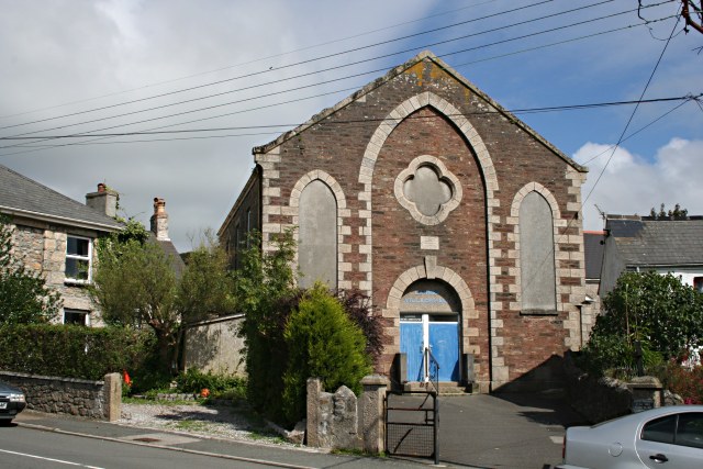
Image: © Tony Atkin Taken: 21 Aug 2007
This seems to be an old Methodist church put to a new use but the blocked up windows at the front of the building give it an air of dereliction.
Images are licensed for reuse under creativecommons.org/licenses/by-sa/2.0
Image Location


Leaflet Map data © OpenStreetMap
Latitude
50.215778
Longitude
-5.204267