Approach to St Michael and All Angels Church, Throwley
Introduction
The photograph on this page of Approach to St Michael and All Angels Church, Throwley by Marathon as part of the Geograph project.
The Geograph project started in 2005 with the aim of publishing, organising and preserving representative images for every square kilometre of Great Britain, Ireland and the Isle of Man.

There are currently over 7.5m images from over 14,400 individuals and you can help contribute to the project by visiting https://www.geograph.org.uk
Approach to St Michael and All Angels Church, Throwley
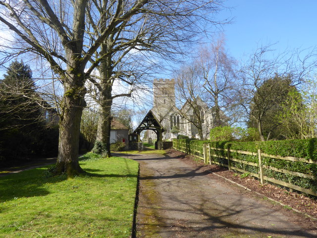
Image: © Marathon Taken: 21 Mar 2017
Approached up this short avenue off Throwley Road with Church House on the right, the tower of St Michael and All Angels Church can be seen from a considerable distance around. The tower dates from the 14th century but was heightened in 1866. There is a Norman west doorway and originally there was an aisleless Norman church. The church reached its present shape in the 14th century but clearly there was the usual 19th century restoration.
Images are licensed for reuse under creativecommons.org/licenses/by-sa/2.0
Image Location
Latitude
51.265022
Longitude
0.853347