Old Milestone by the B4061, Gloucester Road, Morton
Introduction
The photograph on this page of Old Milestone by the B4061, Gloucester Road, Morton by Milestone Society as part of the Geograph project.
The Geograph project started in 2005 with the aim of publishing, organising and preserving representative images for every square kilometre of Great Britain, Ireland and the Isle of Man.

There are currently over 7.5m images from over 14,400 individuals and you can help contribute to the project by visiting https://www.geograph.org.uk
Old Milestone by the B4061, Gloucester Road, Morton
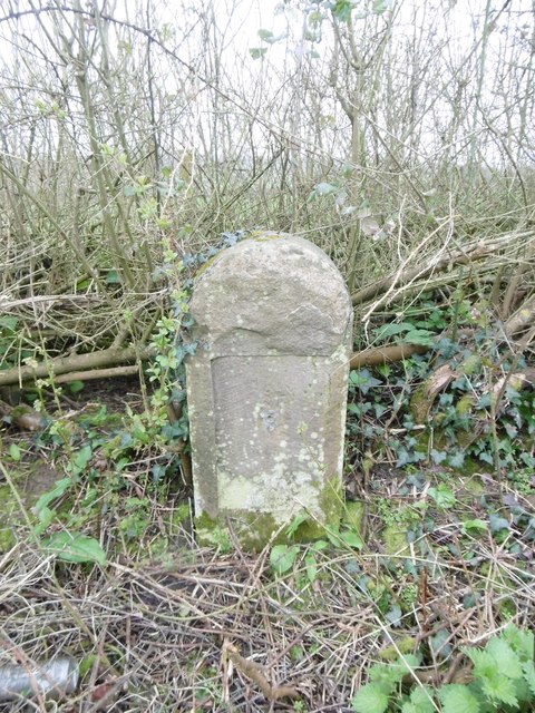
Image: © Milestone Society Taken: 19 Mar 2017
Stone post (plate lost) by the B4061, in parish of THORNBURY (SOUTH GLOUCESTERSHIRE District), Gloucester Road, opposite Our Cottage, in deep ditch on South side of road. Bristol incised iron plate, erected by the Bristol Turnpike Trust in the 19th century. Inscription once read:- (To) (Bristol) (13) (Gloucester) (21) The plate was probably removed as a WWII security measure. Milestone Society National ID: GL_GLBRA21.
Images are licensed for reuse under creativecommons.org/licenses/by-sa/2.0
Image Location
Latitude
51.619824
Longitude
-2.478803