Mappercombe Manor
Introduction
The photograph on this page of Mappercombe Manor by Derek Harper as part of the Geograph project.
The Geograph project started in 2005 with the aim of publishing, organising and preserving representative images for every square kilometre of Great Britain, Ireland and the Isle of Man.

There are currently over 7.5m images from over 14,400 individuals and you can help contribute to the project by visiting https://www.geograph.org.uk
Mappercombe Manor
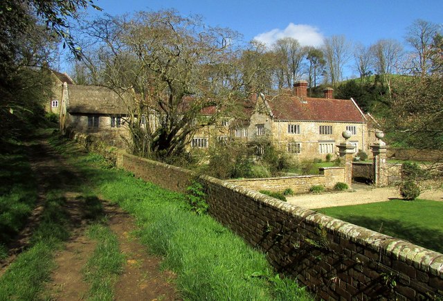
Image: © Derek Harper Taken: 13 Mar 2017
Taken a little further up footpath W39 70 from Image], with the grade I listed manor house https://www.historicengland.org.uk/listing/the-list/list-entry/1216408 and, on the left beside the path, a grade II* listed cider house https://www.historicengland.org.uk/listing/the-list/list-entry/1287653 "dated 1736 ". On the right are garden walls and gatepiers topped with ball finials, also listed https://www.historicengland.org.uk/listing/the-list/list-entry/1216485 .
Images are licensed for reuse under creativecommons.org/licenses/by-sa/2.0
Image Location


Leaflet Map data © OpenStreetMap
Latitude
50.753434
Longitude
-2.69343