Orange Order District Park
Introduction
The photograph on this page of Orange Order District Park by Eric Jones as part of the Geograph project.
The Geograph project started in 2005 with the aim of publishing, organising and preserving representative images for every square kilometre of Great Britain, Ireland and the Isle of Man.

There are currently over 7.5m images from over 14,400 individuals and you can help contribute to the project by visiting https://www.geograph.org.uk
Orange Order District Park
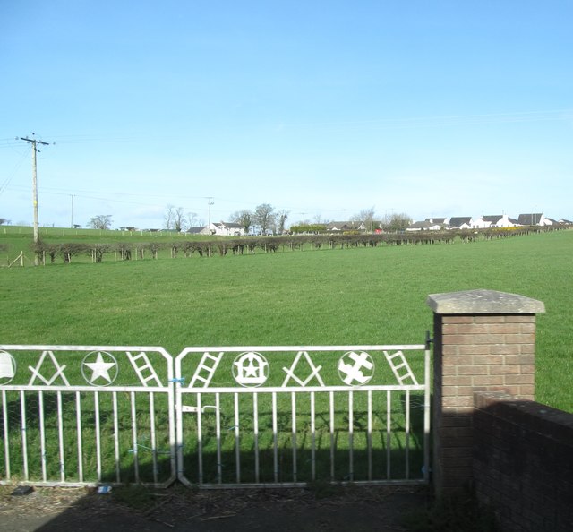
Image: © Eric Jones Taken: 14 Mar 2017
The sacred symbols of Orangeism are depicted on the gates. There is another mustering field on the eastern outskirts of Rathfriland. It is from such fields that local marches, including those of the Twelfth of July, begin and end. Image]
Images are licensed for reuse under creativecommons.org/licenses/by-sa/2.0
Image Location
Latitude
54.235805
Longitude
-6.172007