Charlton Junction
Introduction
The photograph on this page of Charlton Junction by Robin Webster as part of the Geograph project.
The Geograph project started in 2005 with the aim of publishing, organising and preserving representative images for every square kilometre of Great Britain, Ireland and the Isle of Man.

There are currently over 7.5m images from over 14,400 individuals and you can help contribute to the project by visiting https://www.geograph.org.uk
Charlton Junction
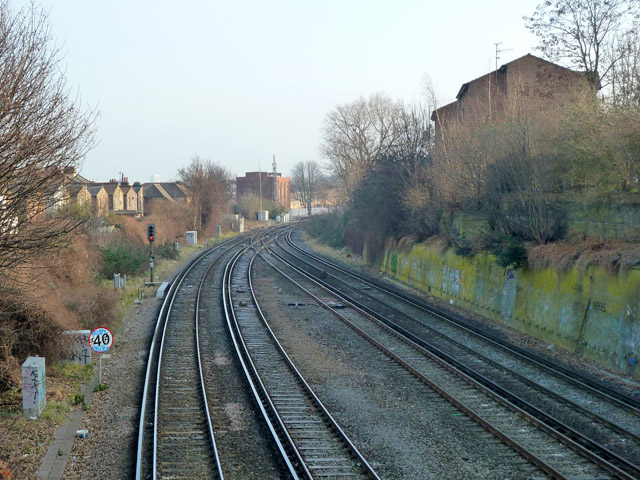
Image: © Robin Webster Taken: 4 Feb 2012
Tracks unite from the direct route to London Bridge via Greenwich on the left, and a connection from a route via Blackheath and Lewisham on the right. Charlton station is just round the bend.
Images are licensed for reuse under creativecommons.org/licenses/by-sa/2.0
Image Location
Latitude
51.485766
Longitude
0.026746