
Morpeth Flood Alleviation Scheme
Introduction
The photograph on this page of Morpeth Flood Alleviation Scheme by Russel Wills as part of the Geograph project.
The Geograph project started in 2005 with the aim of publishing, organising and preserving representative images for every square kilometre of Great Britain, Ireland and the Isle of Man.

There are currently over 7.5m images from over 14,400 individuals and you can help contribute to the project by visiting https://www.geograph.org.uk
Morpeth Flood Alleviation Scheme
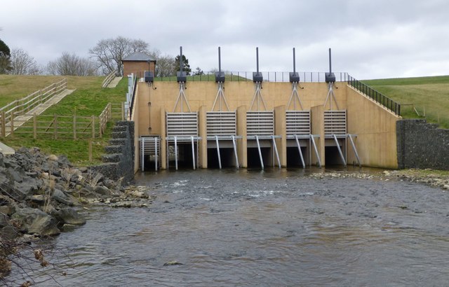
Image: © Russel Wills Taken: 16 Mar 2017
The dam and landscaping now complete. The dam is intended to reduce the risk of the River Wansbeck flooding at Morpeth to one in 137 per year. Controlled flooding will be allowed for up to 5.6 miles, as far upstream as Hartburn, to relieve pressure on Morpeth. Lightwater Cottage, near the dam, will be demolished and rebuilt on higher ground to make it safe from rising water. See http://www.geograph.org.uk/photo/4412836 and http://www.geograph.org.uk/photo/5315370
Images are licensed for reuse under creativecommons.org/licenses/by-sa/2.0
Image Location

Latitude
55.162149
Longitude
-1.761868