King George's Field
Introduction
The photograph on this page of King George's Field by Marathon as part of the Geograph project.
The Geograph project started in 2005 with the aim of publishing, organising and preserving representative images for every square kilometre of Great Britain, Ireland and the Isle of Man.

There are currently over 7.5m images from over 14,400 individuals and you can help contribute to the project by visiting https://www.geograph.org.uk
King George's Field
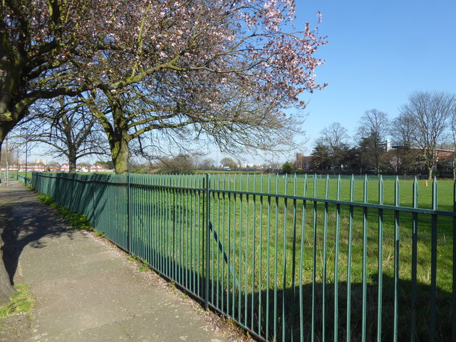
Image: © Marathon Taken: 15 Mar 2017
The nine acre site was purchased by Edmonton Borough Council with the help of a grant of £2,000 from King George's Fields Foundation, from which the playing field gets its name. The Foundation was set up in 1936 following the King's death in order to provide a living memorial to him through funding playing fields for young people. As can be seen from the photograph it is rather featureless. This view is from Delhi Road, while Great Cambridge Road (the A10) is on the far side where the embankment and line of lamp posts can be seen just to the right of the tree.
Images are licensed for reuse under creativecommons.org/licenses/by-sa/2.0
Image Location
Latitude
51.635938
Longitude
-0.069025