Looking north from Edmonton Green station
Introduction
The photograph on this page of Looking north from Edmonton Green station by Marathon as part of the Geograph project.
The Geograph project started in 2005 with the aim of publishing, organising and preserving representative images for every square kilometre of Great Britain, Ireland and the Isle of Man.

There are currently over 7.5m images from over 14,400 individuals and you can help contribute to the project by visiting https://www.geograph.org.uk
Looking north from Edmonton Green station
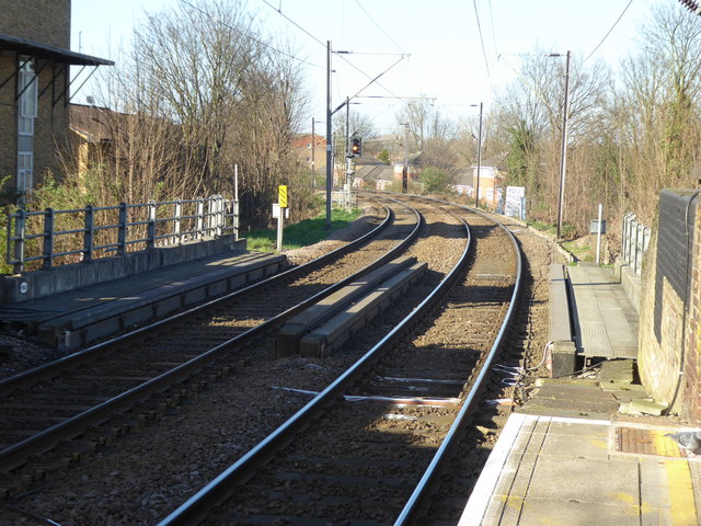
Image: © Marathon Taken: 15 Mar 2017
The line from Edmonton via Lower Edmonton to the centre of Enfield opened on 1st March 1849. At Lower Edmonton (now Edmonton Green) a single platform occupied a central position at the edge of the village green. At Enfield Town where the line terminated in the centre of Enfield, a three-storey, late 17th-century mansion, latterly a school attended by John Keats, was available to become the station house and offices. A little steam railmotor called 'Enfield appeared on the branch soon after its opening. The first stage of a more direct line from Bethnal Green station to Stoke Newington station was opened by the Great Eastern Railway on 27th May 1872, and the route was continued on to Lower Edmonton on 22nd July 1872 and to Edmonton Junction on 1st August 1872. From 1st August 1872 trains ran on to Enfield Town via a new double line. Edmonton Green was opened as Edmonton (High level) on 22nd July 1872 by the Great Eastern Railway on its new, more direct line from London. Edmonton was renamed Lower Edmonton (High Level) on 1st July 1883, with the suffix being dropped when the low level station closed. The name of Edmonton Green was adopted in 1992. The line from Bury Street Junction, north of Edmonton Green, to Cheshunt was opened by the Great Eastern Railway on 1st October 1891 On 31st May 2015 the station and all services that call here became part of the London Overground network.
Images are licensed for reuse under creativecommons.org/licenses/by-sa/2.0
Image Location
Latitude
51.625291
Longitude
-0.061386