Regent's Canal in Maida Vale (1)
Introduction
The photograph on this page of Regent's Canal in Maida Vale (1) by Nigel Cox as part of the Geograph project.
The Geograph project started in 2005 with the aim of publishing, organising and preserving representative images for every square kilometre of Great Britain, Ireland and the Isle of Man.

There are currently over 7.5m images from over 14,400 individuals and you can help contribute to the project by visiting https://www.geograph.org.uk
Regent's Canal in Maida Vale (1)
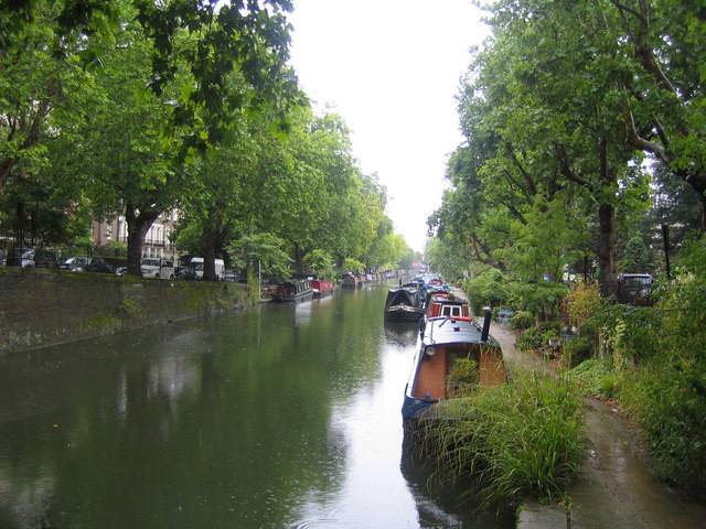
Image: © Nigel Cox Taken: 19 Aug 2007
The Regent's Canal connects the Grand Union Canal to the River Thames at Limehouse Basin. It is 8½ miles or 13.6 kilometres long and drops about 86 feet or 26 metres from Little Venice to the Thames. An entrepreneur by the name of Thomas Homer first proposed the canal in 1802, but it was not until 1811 that he approached the renowned architect John Nash to plan and construct it. Being a good friend of the Prince Regent and already designing Regent's Park, Nash named the new watercourse "The Regent's Canal". Construction work began in 1812 but it was not completed until 1820. This view was taken from the south-western end of the Maida Hill tunnel looking towards Little Venice with Blomfield Road to the right and Maida Avenue to the left. It was raining...
Images are licensed for reuse under creativecommons.org/licenses/by-sa/2.0
Image Location
Latitude
51.523679
Longitude
-0.179442