Nos 107 to 117 Botchergate, May 2013
Introduction
The photograph on this page of Nos 107 to 117 Botchergate, May 2013 by Rose and Trev Clough as part of the Geograph project.
The Geograph project started in 2005 with the aim of publishing, organising and preserving representative images for every square kilometre of Great Britain, Ireland and the Isle of Man.

There are currently over 7.5m images from over 14,400 individuals and you can help contribute to the project by visiting https://www.geograph.org.uk
Nos 107 to 117 Botchergate, May 2013
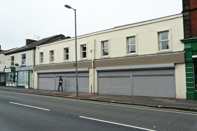
Image: © Rose and Trev Clough Taken: 19 May 2013
This row of buildings was demolished in 2015. The site has been redeveloped with offices for Cumbria County Council, which opened in autumn 2016 - see Image . The block was constructed in the early to mid 19th century. For most of its existence there were shop or business premises fronting onto the street, with residential accommodation upstairs and to the rear. A series of photos taken along Botchergate in 1961 (available at Cumbria Image Bank http://cumbriaimagebank.org.uk/ - search for Jackson TC) shows five different units on this stretch. In the 2013 view three of them have been combined into one office (with shutters), most recently used by the NHS.
Images are licensed for reuse under creativecommons.org/licenses/by-sa/2.0
Image Location
Latitude
54.889964
Longitude
-2.928966