Bournemouth: reconfigured slip road on the Wessex Way
Introduction
The photograph on this page of Bournemouth: reconfigured slip road on the Wessex Way by Chris Downer as part of the Geograph project.
The Geograph project started in 2005 with the aim of publishing, organising and preserving representative images for every square kilometre of Great Britain, Ireland and the Isle of Man.

There are currently over 7.5m images from over 14,400 individuals and you can help contribute to the project by visiting https://www.geograph.org.uk
Bournemouth: reconfigured slip road on the Wessex Way
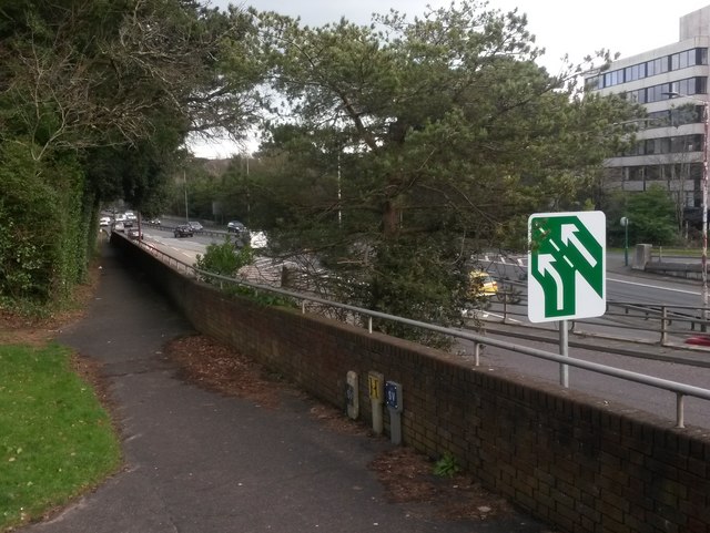
Image: © Chris Downer Taken: 6 Mar 2017
This slip road has been the location of many a minor shunt, as it joins the main Wessex Way with only a very short acceleration lane, and with restricted vision on a blind left-hand sweep of the main carriageway. (See Image for a view of the blind spot and the previous markings.) The junction has therefore sensibly been re-marked, with the slip road becoming the left-hand lane, and only the right-hand lane arriving here on the main line of the road. This is signified by the road sign and also appreciable by way of the road markings in the background. Meanwhile, the footpath on the left drops down to Horseshoe Common.
Images are licensed for reuse under creativecommons.org/licenses/by-sa/2.0
Image Location
Latitude
50.723867
Longitude
-1.875988