Quarry Bank House and Stone Footbridge
Introduction
The photograph on this page of Quarry Bank House and Stone Footbridge by David Dixon as part of the Geograph project.
The Geograph project started in 2005 with the aim of publishing, organising and preserving representative images for every square kilometre of Great Britain, Ireland and the Isle of Man.

There are currently over 7.5m images from over 14,400 individuals and you can help contribute to the project by visiting https://www.geograph.org.uk
Quarry Bank House and Stone Footbridge
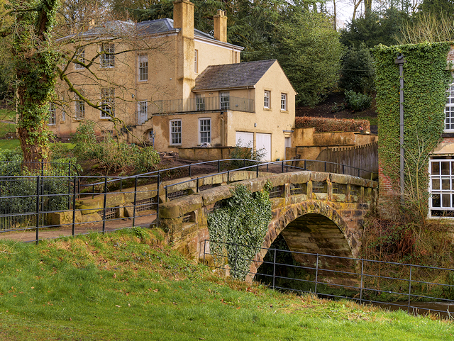
Image: © David Dixon Taken: 6 Mar 2017
The large building is Quarry Bank House. This was built in 1797 for Samuel Greg, owner of the adjacent Quarry Bank Mill, and his family. It is a Grade II listed building (http://www.britishlistedbuildings.co.uk/en-414951-quarry-bank-house- British Listed Buildings). The stone footbridge over the River Bollin, in the foreground next to Quarry Bank Mill, was built for the Gregs in 1820. It carries the path to Morley as well as giving access from the mill to mill meadow (from where this photo was taken) and the garden. It is also a Grade II listed building (http://www.britishlistedbuildings.co.uk/en-414952-the-packhorse-bridge- British Listed Buildings).
Images are licensed for reuse under creativecommons.org/licenses/by-sa/2.0
Image Location
Latitude
53.344174
Longitude
-2.249895