West Sunnyside
Introduction
The photograph on this page of West Sunnyside by Anne Burgess as part of the Geograph project.
The Geograph project started in 2005 with the aim of publishing, organising and preserving representative images for every square kilometre of Great Britain, Ireland and the Isle of Man.

There are currently over 7.5m images from over 14,400 individuals and you can help contribute to the project by visiting https://www.geograph.org.uk
West Sunnyside
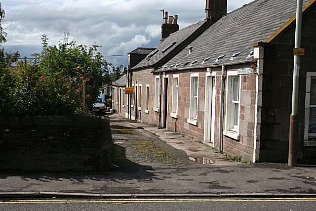
Image: © Anne Burgess Taken: 12 Aug 2007
A row of traditional cottages, shown on the 1865 Ordnance Survey map. At that time they were the last houses in the town on that side of the road from Forfar to Dundee.
Images are licensed for reuse under creativecommons.org/licenses/by-sa/2.0
Image Location
Latitude
56.6404
Longitude
-2.895087