Chippindall House, 4 North Street, Barrow-upon-Soar
Introduction
The photograph on this page of Chippindall House, 4 North Street, Barrow-upon-Soar by Alan Murray-Rust as part of the Geograph project.
The Geograph project started in 2005 with the aim of publishing, organising and preserving representative images for every square kilometre of Great Britain, Ireland and the Isle of Man.

There are currently over 7.5m images from over 14,400 individuals and you can help contribute to the project by visiting https://www.geograph.org.uk
Chippindall House, 4 North Street, Barrow-upon-Soar
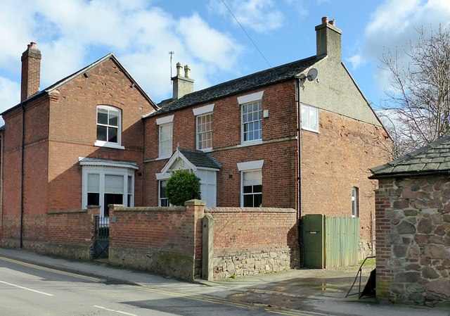
Image: © Alan Murray-Rust Taken: 24 Feb 2017
The oldest part of the house is not visible from the road, but dates from the 17th century. The main front seen here dates from around 1820, and the wing to the left from around 1880. Listed Grade II.
Images are licensed for reuse under creativecommons.org/licenses/by-sa/2.0
Image Location
Latitude
52.753221
Longitude
-1.147878