Opposite wall cap stones
Introduction
The photograph on this page of Opposite wall cap stones by Michael Trolove as part of the Geograph project.
The Geograph project started in 2005 with the aim of publishing, organising and preserving representative images for every square kilometre of Great Britain, Ireland and the Isle of Man.

There are currently over 7.5m images from over 14,400 individuals and you can help contribute to the project by visiting https://www.geograph.org.uk
Opposite wall cap stones
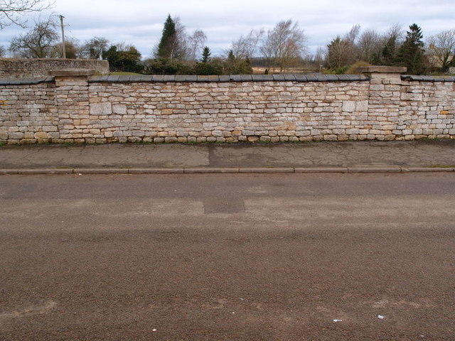
Image: © Michael Trolove Taken: 26 Feb 2017
Unless you know the past geographical history of this area you would think that these are just standard wall cappings but if you scraped away the soil on the other side of the wall you would find that this is a railway bridge for the ironstone quarries that were worked in this parish. A book by Eric Tonks on the Ironstone Quarries of the Midlands Pt 8 South Midlands has two photographs Pg 24 of the cut being dug 1947 and another of the Locomotive travelling through floods in 1953. Looking over the wall you will see the undulations of the land and it is noteworthy to see how close to the village properties the quarrying was allowed to get. Remediation work allowed the land to be returned to agriculture.
Images are licensed for reuse under creativecommons.org/licenses/by-sa/2.0
Image Location
Latitude
52.786962
Longitude
-0.679537