Iford: uphill on footpath I01
Introduction
The photograph on this page of Iford: uphill on footpath I01 by Chris Downer as part of the Geograph project.
The Geograph project started in 2005 with the aim of publishing, organising and preserving representative images for every square kilometre of Great Britain, Ireland and the Isle of Man.

There are currently over 7.5m images from over 14,400 individuals and you can help contribute to the project by visiting https://www.geograph.org.uk
Iford: uphill on footpath I01
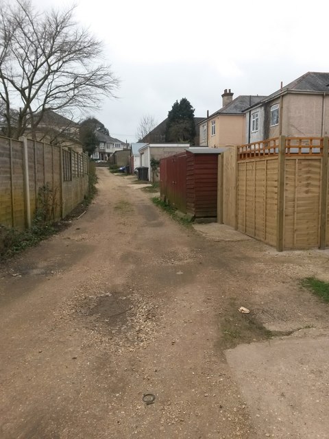
Image: © Chris Downer Taken: 25 Feb 2017
This public footpath is a rather higgledy-piggledy rear access driveway for the shops and flats at odd numbers 1051-1121 Christchurch Road (to our right) and the first even numbers of Corhampton Road (left). This is one of the longest stretches of Christchurch Road without an intervening side turning, so it is a pretty long such driveway, at 233 metres. We look along it here in the southwestward direction, at a reasonable uphill gradient. See Image for the next view on the path ahead, and Image for the next view behind us - each with links to further photos along the route.
Images are licensed for reuse under creativecommons.org/licenses/by-sa/2.0
Image Location
Latitude
50.733413
Longitude
-1.817867