Whitton Pant
Introduction
The photograph on this page of Whitton Pant by Leanmeanmo as part of the Geograph project.
The Geograph project started in 2005 with the aim of publishing, organising and preserving representative images for every square kilometre of Great Britain, Ireland and the Isle of Man.

There are currently over 7.5m images from over 14,400 individuals and you can help contribute to the project by visiting https://www.geograph.org.uk
Whitton Pant
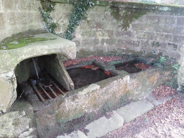
Image: © Leanmeanmo Taken: 22 Feb 2017
Elaborate drinking fountain and troughs. Not sure whether it's mains fed or a spring. Water tasted OK and had no smell. Grade II listed, see https://historicengland.org.uk/listing/the-list/list-entry/1155465
Images are licensed for reuse under creativecommons.org/licenses/by-sa/2.0
Image Location
Latitude
55.303697
Longitude
-1.912866