View from Maudland Bridge
Introduction
The photograph on this page of View from Maudland Bridge by Betty Longbottom as part of the Geograph project.
The Geograph project started in 2005 with the aim of publishing, organising and preserving representative images for every square kilometre of Great Britain, Ireland and the Isle of Man.

There are currently over 7.5m images from over 14,400 individuals and you can help contribute to the project by visiting https://www.geograph.org.uk
View from Maudland Bridge
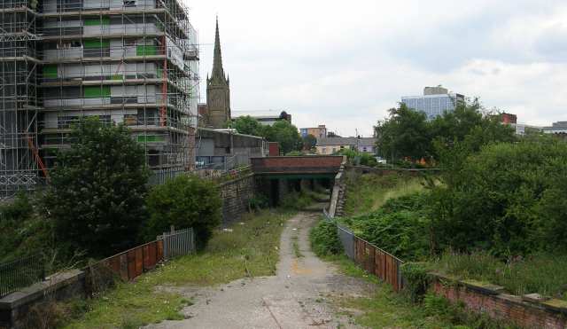
Image: © Betty Longbottom Taken: 12 Aug 2007
The site of the disused Lancaster Canal goes horizontally across the middle of the shot. The tracks of a disused railway can also be seen. From 1856 to 1885 this was the site of Maudlands Bridge railway station, the terminus of a railway line to Longridge. The line closed to passengers in 1930 but continued to be used for goods until the 1990s.
Images are licensed for reuse under creativecommons.org/licenses/by-sa/2.0
Image Location


Leaflet Map data © OpenStreetMap
Latitude
53.76262
Longitude
-2.711092