View from Linfit Lane, Linthwaite
Introduction
The photograph on this page of View from Linfit Lane, Linthwaite by Humphrey Bolton as part of the Geograph project.
The Geograph project started in 2005 with the aim of publishing, organising and preserving representative images for every square kilometre of Great Britain, Ireland and the Isle of Man.

There are currently over 7.5m images from over 14,400 individuals and you can help contribute to the project by visiting https://www.geograph.org.uk
View from Linfit Lane, Linthwaite
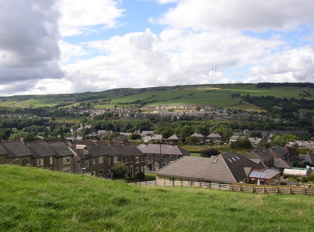
Image: © Humphrey Bolton Taken: 16 Aug 2007
This is the view from the bend next to the driveway to Heywoods Farm. The small patch of light green over the bungalow roof is the green of the Linthwaite Hall Bowling Club. Behind that the row of houses must be Tudor Street. The wireless station at Moorside Edge is on the horizon.
Images are licensed for reuse under creativecommons.org/licenses/by-sa/2.0
Image Location
Latitude
53.619775
Longitude
-1.872973