St Aubyns, Hove
Introduction
The photograph on this page of St Aubyns, Hove by Simon Carey as part of the Geograph project.
The Geograph project started in 2005 with the aim of publishing, organising and preserving representative images for every square kilometre of Great Britain, Ireland and the Isle of Man.

There are currently over 7.5m images from over 14,400 individuals and you can help contribute to the project by visiting https://www.geograph.org.uk
St Aubyns, Hove
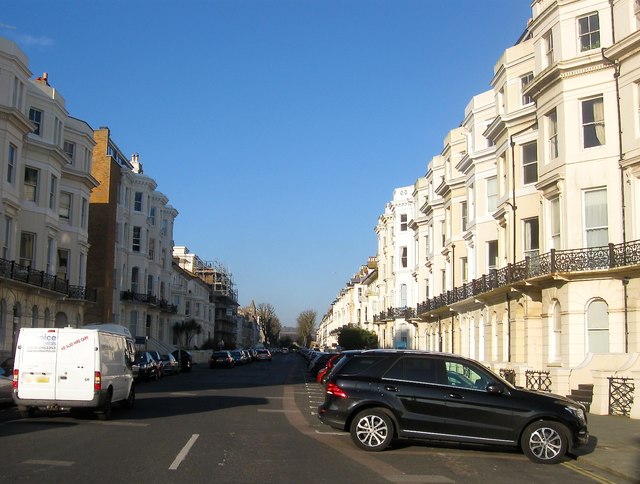
Image: © Simon Carey Taken: 18 Feb 2017
A residential street linking Kingsway, the A259, to Church Road, the B2066, that was developed in stages, the southern part in view was built in the 1860s but the northern end not completed until the 1880s. Virginia Woolf spent a number of her childhood summers at Number 9 on the right next to the black car.
Images are licensed for reuse under creativecommons.org/licenses/by-sa/2.0
Image Location
Latitude
50.825974
Longitude
-0.177325