Road, Rail, River and Canal at Smithy Brook Lane
Introduction
The photograph on this page of Road, Rail, River and Canal at Smithy Brook Lane by Jonathan Clitheroe as part of the Geograph project.
The Geograph project started in 2005 with the aim of publishing, organising and preserving representative images for every square kilometre of Great Britain, Ireland and the Isle of Man.

There are currently over 7.5m images from over 14,400 individuals and you can help contribute to the project by visiting https://www.geograph.org.uk
Road, Rail, River and Canal at Smithy Brook Lane
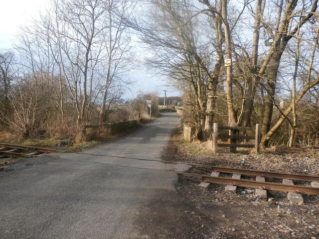
Image: © Jonathan Clitheroe Taken: 17 Feb 2017
Several man-made features of the local landscape can be identified here. Starting at the front we see that the track bed has been relaid, which will create a one mile extension to the Elsecar Heritage Railway from Tingle Bridge Lane at Hemingfield to Cortonwood. Behind the line there is a bridge over Knoll Beck and beyond that is the original bridge crossing the Dearne and Dove Canal.
Images are licensed for reuse under creativecommons.org/licenses/by-sa/2.0
Image Location
Latitude
53.506605
Longitude
-1.398518