Off up to Oldland Station
Introduction
The photograph on this page of Off up to Oldland Station by Neil Owen as part of the Geograph project.
The Geograph project started in 2005 with the aim of publishing, organising and preserving representative images for every square kilometre of Great Britain, Ireland and the Isle of Man.

There are currently over 7.5m images from over 14,400 individuals and you can help contribute to the project by visiting https://www.geograph.org.uk
Off up to Oldland Station
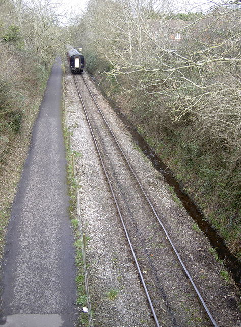
Image: © Neil Owen Taken: 16 Feb 2017
The train passes under West Street bridge. Alongside the single track is a cycle path and, on the other side of it, a small stream. The track was originally part of the Midland branch line from Mangotsfield: it opened in 1865, became part of the LMS line later and finally closed to official traffic on 7th March, 1966. It is now a preserved railway.
Images are licensed for reuse under creativecommons.org/licenses/by-sa/2.0
Image Location


Leaflet Map data © OpenStreetMap
Latitude
51.440734
Longitude
-2.471431