Snake Path
Introduction
The photograph on this page of Snake Path by Stephen McKay as part of the Geograph project.
The Geograph project started in 2005 with the aim of publishing, organising and preserving representative images for every square kilometre of Great Britain, Ireland and the Isle of Man.

There are currently over 7.5m images from over 14,400 individuals and you can help contribute to the project by visiting https://www.geograph.org.uk
Snake Path
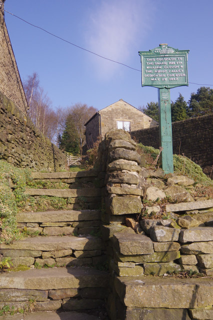
Image: © Stephen McKay Taken: 14 Feb 2017
Few footpaths have much recorded history associated with them, but this route from Hayfield to the Snake Inn was, as the sign tells, secured by the Peak District and Northern Counties Footpaths Society in 1897 'for ever'. This must have been a significant innovation at the time, coming many years before the famous Kinder mass trespass of 1932.
Images are licensed for reuse under creativecommons.org/licenses/by-sa/2.0
Image Location


Leaflet Map data © OpenStreetMap
Latitude
53.378219
Longitude
-1.940283