A railway right in front of the school
Introduction
The photograph on this page of A railway right in front of the school by Neil Owen as part of the Geograph project.
The Geograph project started in 2005 with the aim of publishing, organising and preserving representative images for every square kilometre of Great Britain, Ireland and the Isle of Man.

There are currently over 7.5m images from over 14,400 individuals and you can help contribute to the project by visiting https://www.geograph.org.uk
A railway right in front of the school
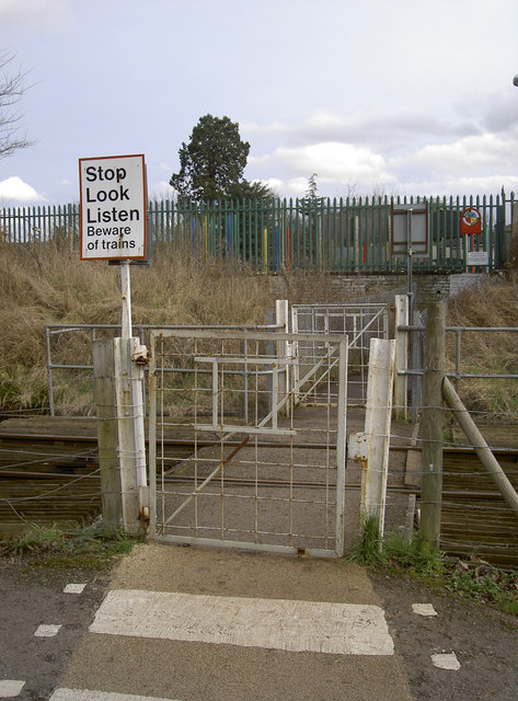
Image: © Neil Owen Taken: 16 Feb 2017
The other entrance to St Anne's primary school is on the road, on the opposite side of the site. This entrance happens to be right on a railway line, and needs care to cross. The line is now a rather infrequently run preserved railway; in the past this line would have been much busier, but had closed before this modern school was built. Note the white track irons used for gateposts.
Images are licensed for reuse under creativecommons.org/licenses/by-sa/2.0
Image Location


Leaflet Map data © OpenStreetMap
Latitude
51.438924
Longitude
-2.47429