Linfit Lane, Linthwaite
Introduction
The photograph on this page of Linfit Lane, Linthwaite by Humphrey Bolton as part of the Geograph project.
The Geograph project started in 2005 with the aim of publishing, organising and preserving representative images for every square kilometre of Great Britain, Ireland and the Isle of Man.

There are currently over 7.5m images from over 14,400 individuals and you can help contribute to the project by visiting https://www.geograph.org.uk
Linfit Lane, Linthwaite
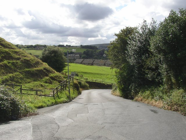
Image: © Humphrey Bolton Taken: 16 Aug 2007
Here the lane has shaken off the suburban development and climbs with a curvy zigzag. On the left there are steps in the steep grassy slope. They are a common feature in this area, and are not wide enough to be cultivation terraces but are perhaps the result of soil gradually slipping down the slope (?).
Images are licensed for reuse under creativecommons.org/licenses/by-sa/2.0
Image Location
Latitude
53.618876
Longitude
-1.872976