Field with a view, Linthwaite
Introduction
The photograph on this page of Field with a view, Linthwaite by Humphrey Bolton as part of the Geograph project.
The Geograph project started in 2005 with the aim of publishing, organising and preserving representative images for every square kilometre of Great Britain, Ireland and the Isle of Man.

There are currently over 7.5m images from over 14,400 individuals and you can help contribute to the project by visiting https://www.geograph.org.uk
Field with a view, Linthwaite
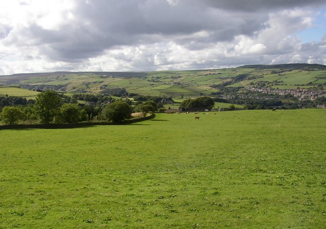
Image: © Humphrey Bolton Taken: 16 Aug 2007
Taken from the junction of Holt head Road and Jerusalem Road. The building at the bottom of the field (in the next square) is Park. Beyond it is another house with the equally terse name of Binn. The valley side is convex, so that the view passes right over the U-shaped valley floor to the far hillside, with the ribbon development along Longlands Road, Slaithwaite, to the right, and the open countryside of Bradshaw to the centre and left.
Images are licensed for reuse under creativecommons.org/licenses/by-sa/2.0
Image Location


Leaflet Map data © OpenStreetMap
Latitude
53.612584
Longitude
-1.872994