Stopham Bridge
Introduction
The photograph on this page of Stopham Bridge by Simon Carey as part of the Geograph project.
The Geograph project started in 2005 with the aim of publishing, organising and preserving representative images for every square kilometre of Great Britain, Ireland and the Isle of Man.

There are currently over 7.5m images from over 14,400 individuals and you can help contribute to the project by visiting https://www.geograph.org.uk
Stopham Bridge
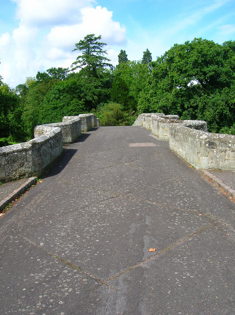
Image: © Simon Carey Taken: 17 Aug 2007
There was a ford at this point since Saxon times which was replaced by a wooden bridge in 1309. This in turn was replaced by a stone bridge in 1423 which remained in use until 1986 when a new road bridge was opened. This view looks towards the centre from the eastern side, raised in 1822 to allow masted vessels to access the Arun-Wey navigation.
Images are licensed for reuse under creativecommons.org/licenses/by-sa/2.0
Image Location


Leaflet Map data © OpenStreetMap
Latitude
50.955396
Longitude
-0.53577