The Helix Bridge, Paddington Basin
Introduction
The photograph on this page of The Helix Bridge, Paddington Basin by Stephen McKay as part of the Geograph project.
The Geograph project started in 2005 with the aim of publishing, organising and preserving representative images for every square kilometre of Great Britain, Ireland and the Isle of Man.

There are currently over 7.5m images from over 14,400 individuals and you can help contribute to the project by visiting https://www.geograph.org.uk
The Helix Bridge, Paddington Basin
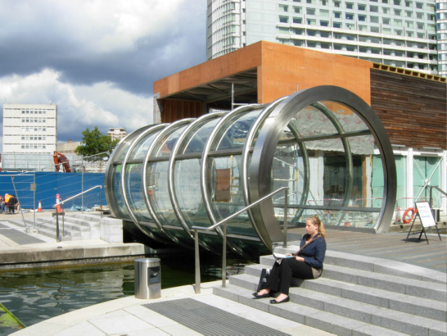
Image: © Stephen McKay Taken: 16 Aug 2007
This unusual canal bridge was closed to pedestrians, presumably due to the work taking place on the opposite bank; the white notice gives alternative directions. For a technical description of the bridge see http://www.lusas.com/case/bridge/helix_bridge.html
Images are licensed for reuse under creativecommons.org/licenses/by-sa/2.0
Image Location
Latitude
51.519155
Longitude
-0.171839